What is Smart Road?
Author: Release time:2022-04-25 03:29:57
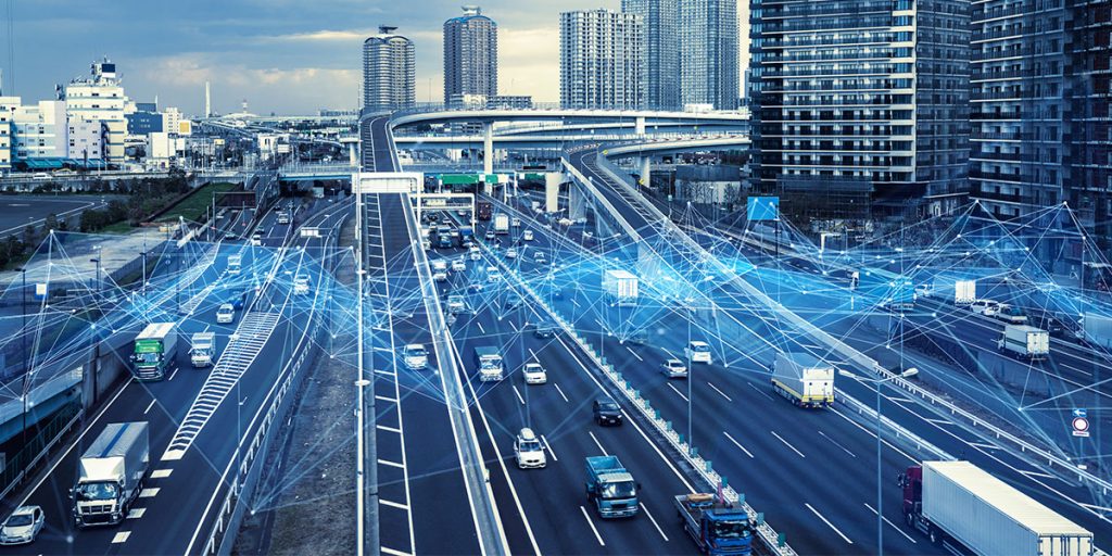
Smart road refers to a kind of multi-functional integrated road infrastructure system, which comprises three parts, namely autonomous vehicles, smart road infrastructure, vehicle-road communication, and collaboration. The goal of smart roads is to build a vehicle-road integrated system based on electronic, communication, and automation technologies, to provide global, real-time, and prior information, and to maximize the ability to improve road traffic among different vehicles and under real-time communication environments, and to assist Intelligent and Connected Vehicle (ICV) to improve environmental perception and instant communication capabilities, reduce vehicle hidden safety hazards and solve traffic congestion, and achieve success V2X effect.

With the continuous improvement of smart road information perception, processing, transmission, computer, and fusion decision-making systems, smart roads will eventually reach the stage of digital twin road, to achieve an advanced stage with parallel intelligence features that “physical roads and digital roads coexist, and the two interact virtual and real information and together realize ‘decision-control-management’ functions”.
The composition of the smart road
The structure of the entire smart road includes four layers, namely perception, network communication, decision processing, and service providing. Using edge computing equipment (car terminals, roadside equipment, etc.), smart roads can collect and perceive the driving status of vehicles and road conditions in real time, and use ubiquitous networks such as 5G, RFID, and DSRC to realize the interconnection and intercommunication between entities of smart roads. Then smart roads can use big data and cloud platform technologies such as databases and big data analysis platforms to dynamically interact with data, information mining, and intelligent decision-making and a series of processing, to provide vehicles, drivers, administrators, and other participants with overall and effective information services.
Eight Technologies for Smart Roads

(1) Road smart material technology: Road smart materials can autonomously perceive the environment, then analyze, process and judge the environment. The excellent characteristics enable the road to have intelligent functions such as information collection, self-diagnosis, and information interaction and improve road service capabilities.
(2) High-precision map technology: Real-time and precise positioning of vehicles on smart roads can be realized by integrating wireless positioning, inertial navigation positioning, satellite positioning, vehicle autonomous positioning, RSU-assisted positioning, and high-precision maps.
(3) Vehicle queuing technology: Distance detection sensors and vehicle-vehicle/vehicle-road communication technology help to maintain a certain safe distance between multiple vehicles so that the entire fleet forms a consistent entirety.
(4) V2X network communication technology: the basis for realizing highly intelligent vehicle-road communication &collaboration and ubiquitous network coverage (such as 5G, DSRC, RSRC, Wi-Fi, etc.) lies on heterogeneous network integration and spectrum resource sharing.
(5) Wireless charging technology: The wireless charging module is deployed on the smart road, and new energy such as solar energy provides electricity, which reduces the power battery capacity of electric vehicles, saves energy and reduces emissions, and reduces the operating costs of electric vehicles.
(6) Active-safety-oriented road control technology: Starting from the road infrastructure itself, improve the driving safety and stability of the road with real-time monitoring, advanced prediction, automatic perception, automatic repair, and other working modules.
(7) Intelligent decision-making and planning combined with infrastructure: including single-vehicle intelligent decision-making behavior (lane changing, overtaking, merging into traffic, etc.) and multi-vehicle co-movement planning (solving the paths or trajectories of multiple vehicles).
(8) Vehicle-road interaction technology: Mobility-as-a-Service (MaaS) aims to establish a seamless networked transportation system based on shared transportation modes and intelligent information technology.
LiDAR Powers Smart Roads
At present, in the data source part of the fusion system, the commonly used sensors are cameras, millimeter-wave radars, and LiDARs. The camera can detect the type of traffic participants (such as pedestrians, vehicles, cyclists) and other information, but it is affected by the weather and light intensity; millimeter-wave radar can accurately detect the location, speed, and other information of the target and will not be affected by the weather. But it cannot detect the static target, and the detected target has more noise;

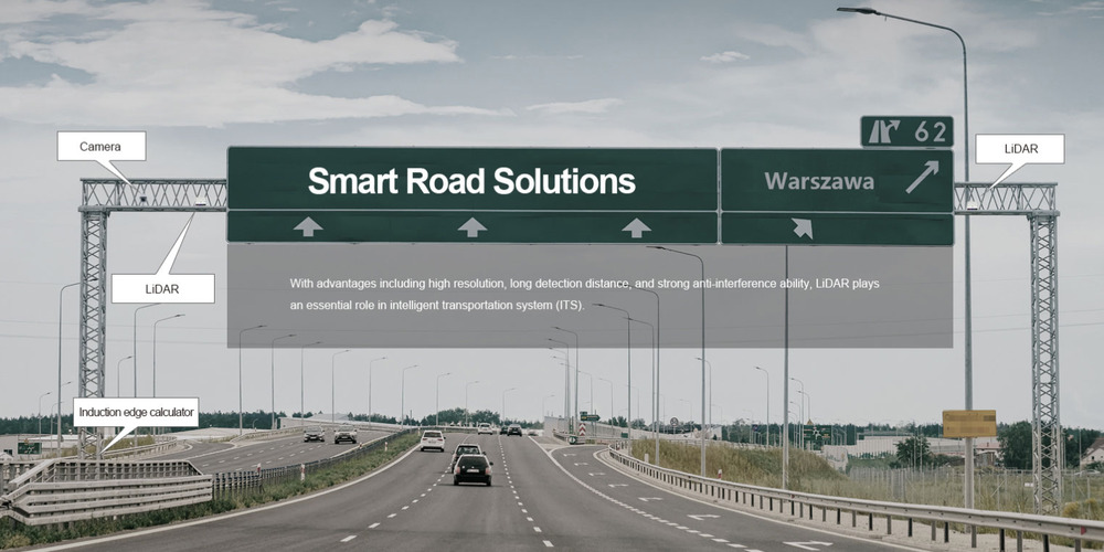
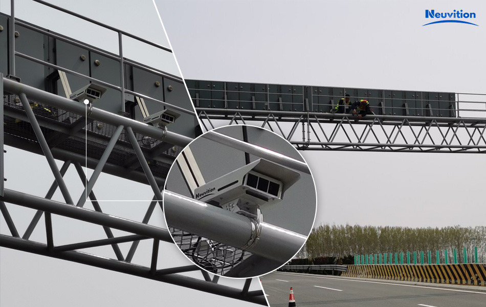
LiDAR can accurately detect the position, speed, and size of stationary and moving targets. As an essential role in the perception layer, LiDAR can not only help vehicles sense the road conditions in real time, but can also help communicate between vehicles and traffic monitoring infrastructure, etc. LiDAR is currently “installed on poles at intersections” and monitors traffic to improve “flow at intersections.” By fusing the data of multiple sensors, the advantages of different sensors can achieve the effect of promoting strengths and avoiding weaknesses.
LiDAR-based traffic monitoring can identify pedestrians, cyclists, and other road users who are approaching traffic lights in real time. It measures the speed and number of cars in different lanes and at traffic lights.
Armed with this data, monitoring software can alter traffic light intervals to reduce pedestrian wait time and improve overall traffic flow.
We are still a long way from a fully connected smart city with massive numbers of self-driving cars, delivery robots, or a fully connected smart city where road users communicate seamlessly with other urban infrastructure. LiDAR plays a very important role in optimizing urban traffic, and traffic monitoring systems can help people travel more safely in ways beyond imagination.
Introduction to Neuvition
Suzhou Neuvition Technology Co., Ltd. is a provider of innovative LiDAR applications and technical service solutions, providing high-quality LiDAR sensors, LiDAR software services, and complete solutions for users around the world.
Neuvition is one of the suppliers earliest to focus on the MEMS high-resolution solid-state LiDAR technology based on the MEMS+1550nm technology route. It has the world’s leading 700-line high-resolution, 600-meter ultra-long detection range and advanced video fusion technology.
The functions of Neuvition LiDAR-based V2X Smart Road Solution include but not limited to:

- Detection output of vehicle L*W*H, vehicle speed, etc;
- Real-time location output, ID detection & tracking;
- Data fusion of cameras, LiDARs, and other sensors;
- System calibration, providing information such as longitude, latitude, direction and angle.
- To help customers solve problems such as over-limit (length, width, height) detection, road congestion, danger ahead, overspeed, and tunnel safety.