Smart City Growth Needs LiDAR
Author: Release time:2023-03-08 09:00:13
What is a smart city?
A new urban management model known as the “smart city” is based on cutting-edge technology. Through the use of data and information technology, it seeks to improve social governance, increase urban service levels, and optimize urban management, economic development, and sustainable urban development. To build smart cities, comprehensive and systematic solutions must be considered at various levels, including hardware infrastructure, network technology, data services, application systems, management and service integration, and product integration. The objective of a “smart city” is to achieve smart governance, smart operation, and smart services through comprehensive transportation technology, using big data and “smart” technology, to achieve effective resource allocation for the city and realize prosperity and convenience for the populace.
Classification of smart city technology levels
Based on the definition of a smart city, we can divide smart city technical support into three levels: underlying technology, application layer technology, and networking technology. The underlying technology consists of sensors, RFID, Bluetooth, and other devices that gather data about the urban environment, its parameters, and its status before sending it to the cloud. To analyze these data, produce and control instructions, and modify the environment in real-time, application layer technology is used. Networking technology is the foundation of smart city architecture, which includes systems such as smart homes, smart security, and smart transportation, among others.
What can LiDAR do for a smart city?
LiDAR (Light Detection and Ranging) technology has the potential to revolutionize the smart cities of the future. It can be used for a variety of applications, from traffic control to autonomous navigation, and even for monitoring air quality. LiDAR can create 3D maps of an area, which can be used to identify potential hazards or opportunities in a city. It can also provide data on how people move around a city and what areas are the most popular. This data can then be used by city planners to make decisions about how best to use resources and allocate funds for future projects. As such, LiDAR is an important tool for creating smarter cities that are more efficient, safe, and enjoyable places to live.
The role of LiDAR as a three-dimensional sensor
LiDAR is becoming more and more crucial in the development of smart cities as a critical three-dimensional sensor. It can give a city’s managers access to a wide range of data, assisting them in developing a better understanding of how the city as a whole operates so they can make more informed decisions to raise the level of operation.
LiDAR is used in smart cities to collect information such as road congestion, vehicle parking, street pedestrian density, and so on, to assist city managers in better organizing and managing the city’s logistics, traffic, and life. LiDAR is used to create maps, create and update highly accurate 3D maps based on real-time data, create smart city systems, and raise the management standard of various city facilities. LiDAR is also used to monitor and provide early warning for urban security threats. The advantage of LiDAR lies in its high precision, high sensitivity, and high accuracy, which can describe the target objects in the urban environment more thoroughly, and its detection ability is stronger in complex environments, such as dense fog and at night.
What can Neuvition LiDAR do for a smart city?
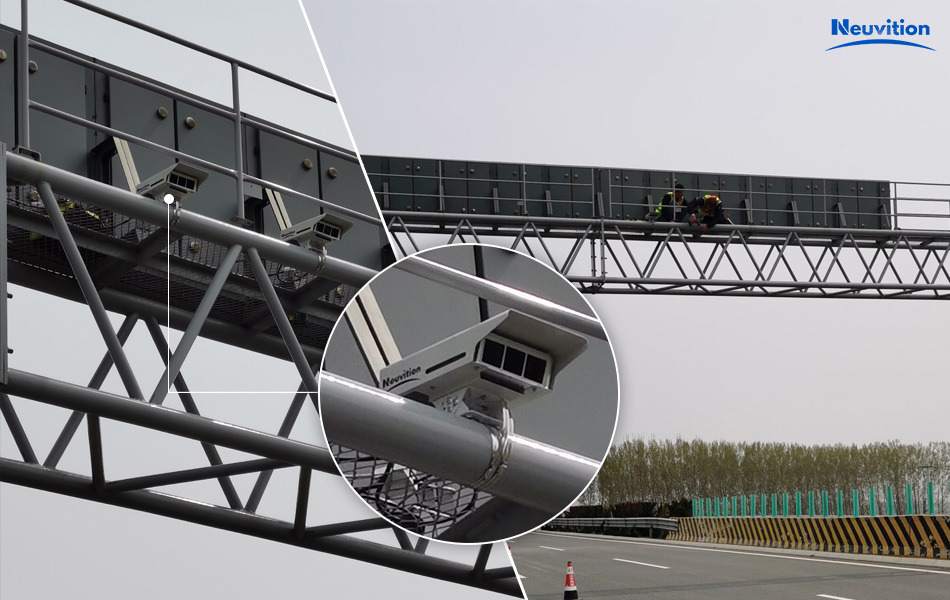
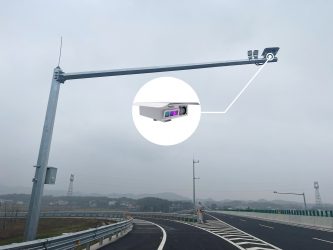
V2X/Smart Road
The functions of Neuvition V2X Smart Road Solution include but not limited to:
- Detection output of vehicle L*W*H, vehicle speed, etc;
- Real-time location output, ID detection&tracking;
- Data fusion of cameras, LiDARs, and other sensors;
- System calibration, providing information such as longitude, latitude, direction, and angle.
- To help customers solve problems such as over-limit (length, width, height) detection, road congestion, danger ahead, overspeed, and tunnel safety.
Customer use case photos:


Smart Airport
LiDAR-based Airport Parking Guidance ADAS Solution
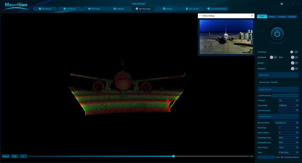
Neuvition LiDAR Titan M1’s vertical 480 lines, horizontal FOV of 45°, 1550nm laser-based echo signal measurement technology collects front apron point cloud data. With an HD camera, combined with point cloud-video fusion algorithm, the system generates a 3D high-precision apron map, and the data map is generated through calibration to realize aircraft parking guidance. After the point cloud data detected by LiDAR is sent to the system host, through algorithms, the system calculates, analyzes, and stores the data for aircraft model identification, detection of remaining distance and approach speed.
Customer use case photo:

Smart Ship
Neuvition LiDAR-based Ship Safety Driving Assistance System
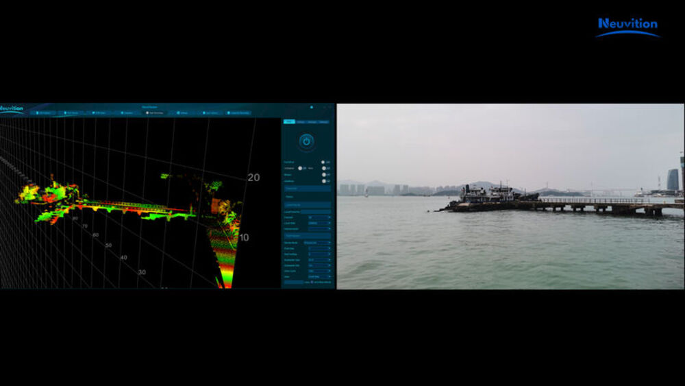
Neuvition LiDAR Titan M1-R is recommended for securing the ship driving assistance system. Through the high fusion information of LiDAR and camera point cloud data, the 3D vision of sailing ships can be reconstructed to perceive the surrounding ships, identify the position of the ship itself and other nearby ships, and measure the distance between the nearby ships, to smartly and safely pass the bridge without collision.
Customer use case photo:

About Neuvition
Neuvition Inc. is a global LiDAR sensors and solutions provider, providing customers with advanced LiDAR sensors and customized solutions to meet customers’ business challenges in scenarios including automatic driving, intelligent transportation, 3D mapping, volume measurement, industrial machine vision, etc.
Our customers and partners are located in North America, Europe, Asia, and other regions. As a trusted partner, we will continue to work with our customers and partners to develop more and more innovative products and solutions to deliver a seamless converged experience and improve efficiency and productivity, and even save lives.